
10 best hikes in New Zealand for every kind of walker
By Eva Alkemade
Aug 20, 2026
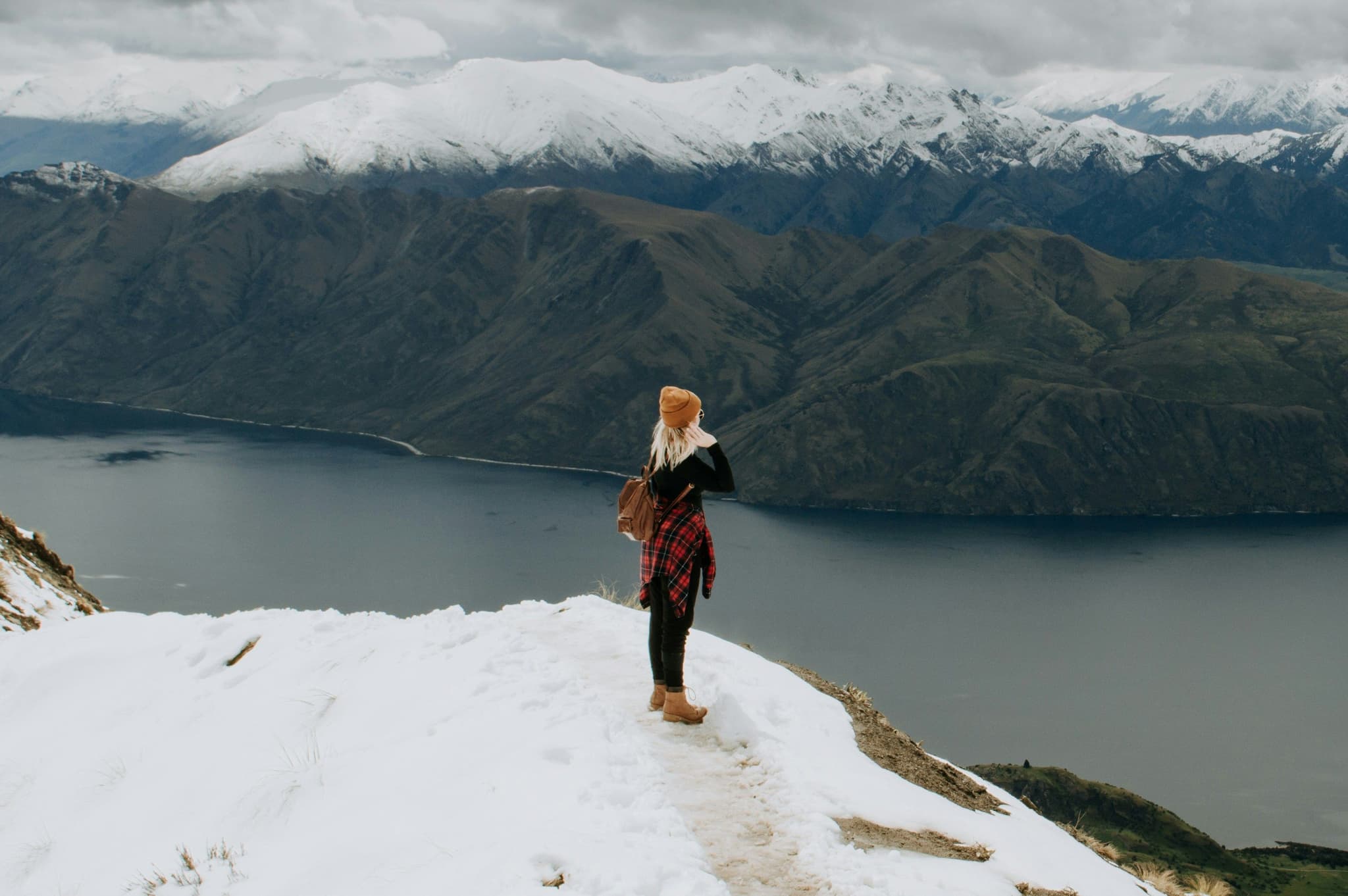
Breakfast on a black sand beach, lunch beside a glacier and an evening watching steam rise out of an active crater. New Zealand has coastlines, rainforest, volcanoes and alpine passes, and hiking is by far the best way to get close to all of it. Locals call it tramping, and once you've done even one of these trails you'll understand why so many people plan an entire trip around a backpack and a good pair of boots. We’ll tell you about all the trails, including the bits nobody tells you beforehand, like how muddy it gets, whether you'll need to book months ahead, and where to grab a shuttle. Lace up, because these 10 best hikes in New Zealand are worth building your whole itinerary around!
Things to know before you go hiking in New Zealand
The Tongariro Alpine Crossing is considered the best day hike in New Zealand
New Zealand's ten Great Walks need hut or campsite bookings months in advance
October to April is the main hiking season, in particular January and February
The South Island has mountains and glaciers, while the North Island has volcanoes and coastal walks.
You don't need a multi day trek to see the best of it. Several of the NZ hikes take under three hours.
Tongariro Alpine Crossing: the hike everyone talks about
Ask any Kiwi for the best day hike in New Zealand and this is the one they'll mention first. The 19.4 kilometre crossing takes you through Tongariro National Park, a UNESCO World Heritage site, past steaming vents, the emerald coloured lakes and the black cone of Mount Ngauruhoe, better recognised by Lord of the Rings fans as Mount Doom.
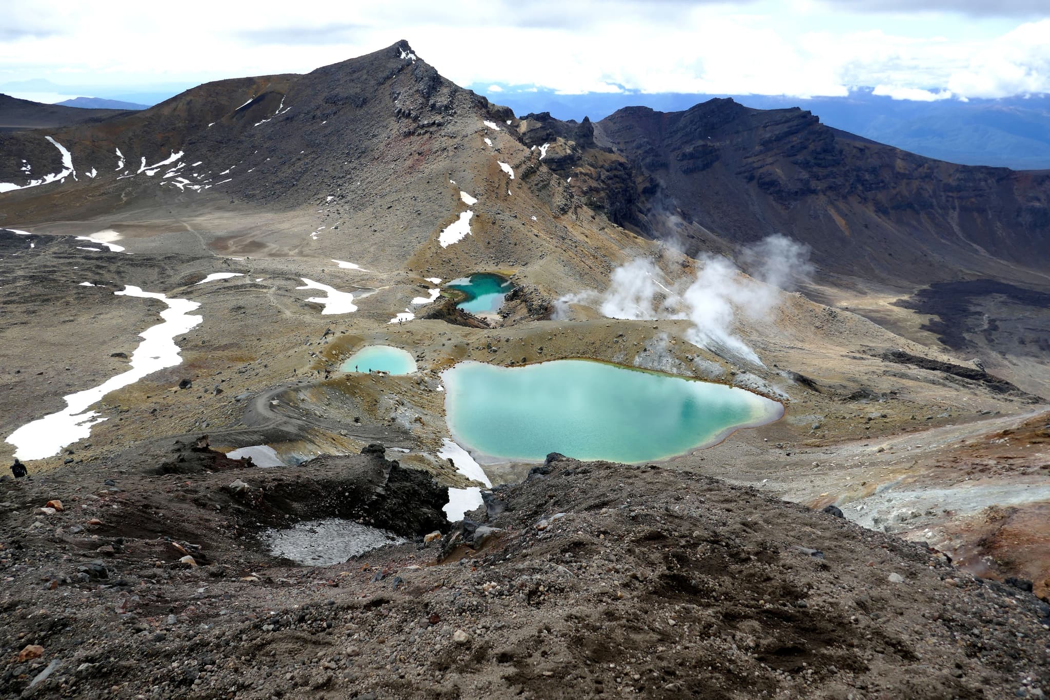
You can do this one in eight hours including plenty of photo stops, and honestly, the middle section around Red Crater is where it earns its reputation. You'll climb around 800 metres in the first couple of hours, which is the part that really gets your legs burning, then the trail flattens out past the Emerald Lakes before dropping back down through farmland to the car park at the other end. Also read the official track info: Tongariro Alpine Crossing official track page (DOC).
You won't be able to drive yourself and leave a car at both ends, since parking is limited to four hours at either trailhead. Almost everyone books a shuttle from Taupo, Turangi or National Park Village instead, which drops you at one end and picks you up at the other. There's no entrance fee for the crossing itself, just the cost of your shuttle, which usually runs somewhere between 45 and 55 NZD.
Expect to get your boots muddy in a few sections, and pack a proper rain layer even if the forecast looks clear, because the weather on an exposed volcanic ridge can turn in minutes.
Want more of the North Island's volcanic side before you commit to the crossing? Our New Zealand North Island guide covers Tongariro National Park in more depth, along with where to base yourself nearby.
Milford Track: four days through Fiordland
Often called the finest walk in the world, the Milford Track is one of New Zealand’s day hikes, a 53.5 kilometre track that takes four days to complete, starting with a boat trip across Lake Te Anau and ending at the edge of Milford Sound. Along the way you'll pass Sutherland Falls, one of the tallest waterfalls in New Zealand, and cross Mackinnon Pass with views over the valleys on either side.
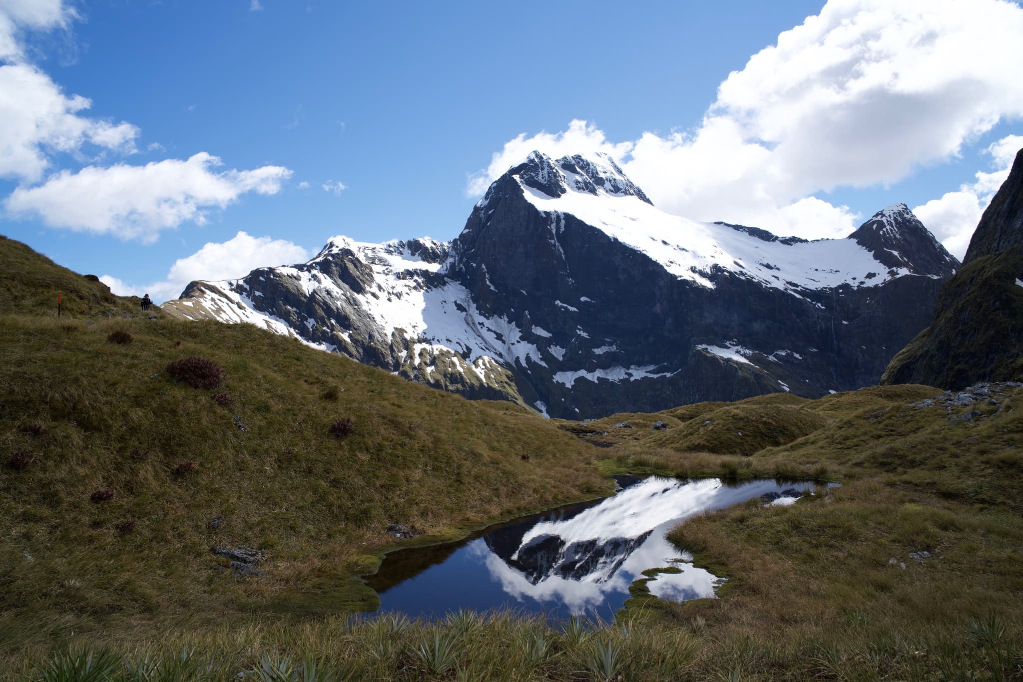
We'll be upfront with you, this one takes real planning. Hut bookings for the 2026/27 season cost around 106 NZD a night for New Zealand residents and 152 NZD for everyone else, and you need all four nights booked before you're allowed on the track. Bookings open in May and the most popular dates disappear within hours, so set a reminder and be logged into your DOC account before the clock starts. Also read the official track info: Milford Track official track page (DOC).
Fiordland gets some of the highest rainfall in the country, so pack for wet feet regardless of the season, and budget for return transport from Milford Sound back to Te Anau or Queenstown once you finish, since the track is one way.
Routeburn Track: a Great Walk with a view around every corner
Running for 32 kilometres between Glenorchy and the Milford road, the Routeburn Track crosses both Mount Aspiring and Fiordland National Parks in two to three days. You'll pass beech forest, alpine lakes, waterfalls and the Harris Saddle, with several side trips like Conical Hill for anyone who wants extra views without extra kilometres.
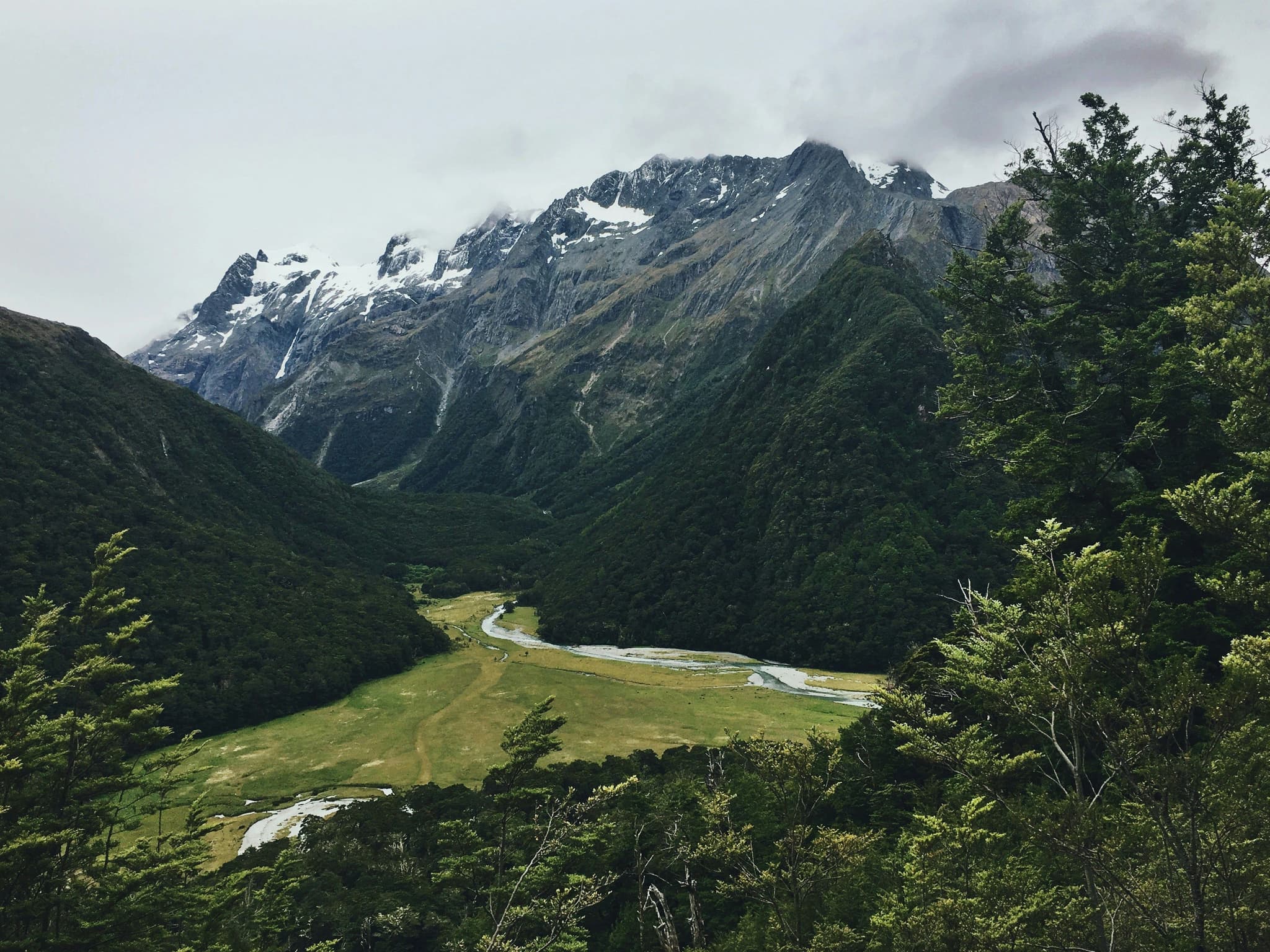
Because the track finishes 325 kilometres by road from where it starts, sorting out transport matters just as much as sorting out huts here. Most people either book a car relocation service, take a shuttle between Queenstown, Glenorchy and Te Anau, or hike it with a friend who's happy to swap car keys halfway.
Hut prices sit around 102 NZD a night for the 2026/27 season, and bookings usually open in May, a little after Milford. The Harris Saddle section is the most exposed to wind and rain, so even on a clear morning in Glenorchy, pack like the weather at the top will be completely different. Also read the official track info: Routeburn Track official track page (DOC).
Guided tip: If huts are booked out, you can still day hike sections of the Routeburn from the Divide or Routeburn Shelter and turn back whenever you like, no booking required.
Roy's Peak: Wanaka's most photographed climb
Ten minutes from Wanaka, Roy's Peak Track has become one of the most recognised day hikes in New Zealand thanks to that single photo spot overlooking Lake Wanaka. The climb itself is eight kilometres each way with a 1,300 metre elevation gain, and it's rated hard because of how steep and relentless it is from start to finish.
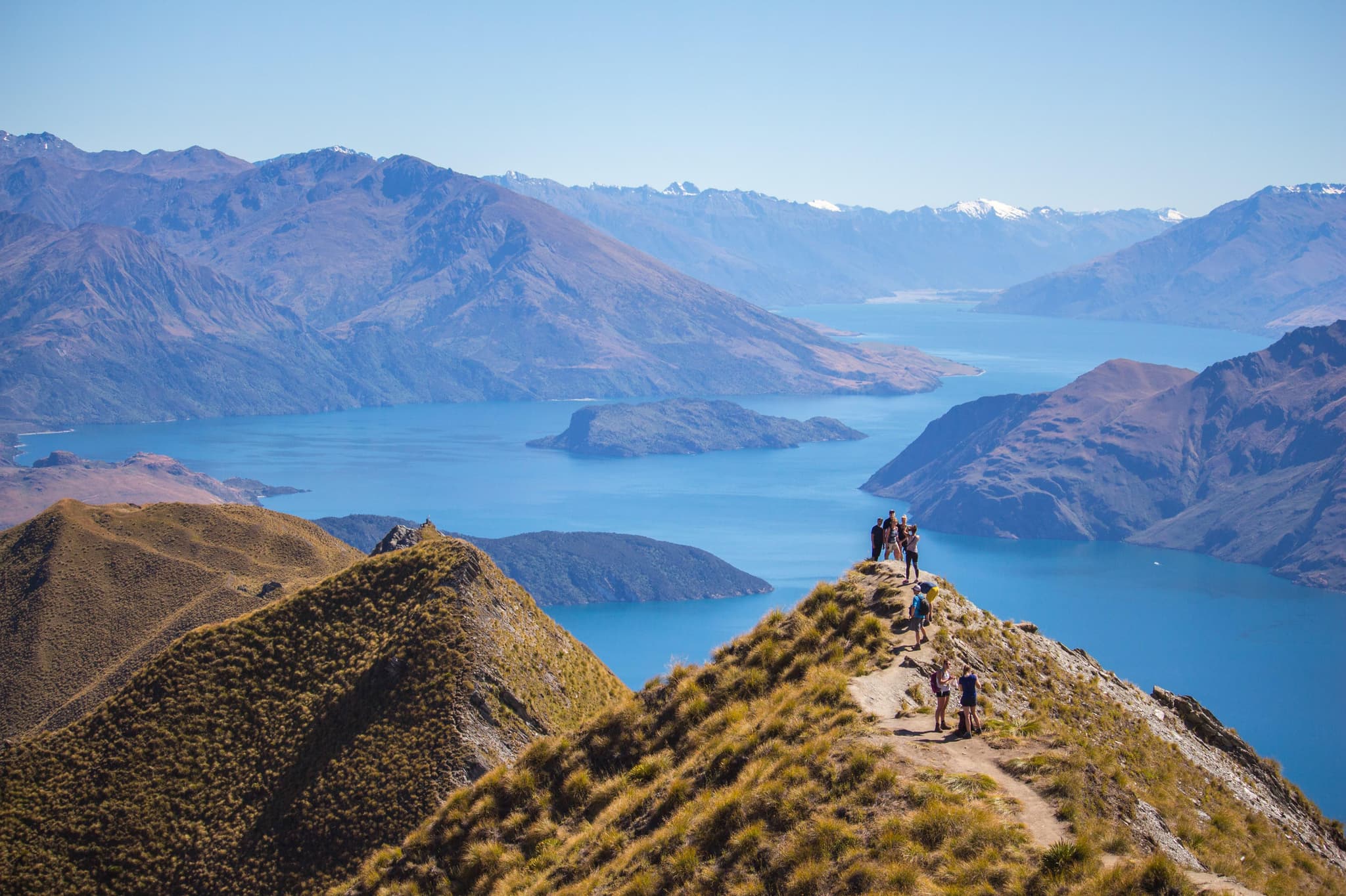
We recommend starting before sunrise if you can manage it. The track is completely exposed with no shade, so a hot summer afternoon on the switchbacks is not much fun, and you'll also dodge the queue that builds up at the famous photo point by mid morning. There's no fee to hike it and no booking needed, just free parking at the trailhead, though it fills up fast in summer. Also read the official track info: Roy's Peak Track official track page (DOC).
One thing to know before you drive out there: the track closes every year for lambing season, from 1 October to 10 November, and reopens on 11 November, so double check the dates if you're visiting in spring.
Hooker Valley Track: an easy walk to Aoraki
For a hike that rewards you without punishing your legs, head to Aoraki Mount Cook National Park. The Hooker Valley Track is one of the best walks in New Zealand if you’re looking for good views without extreme conditions. It’s a fairly flat five-kilometre walk each way, crossing swing bridges over the Hooker River before ending at Hooker Lake, where you'll get a straight on view of Aoraki, New Zealand's tallest mountain, and its glacier.
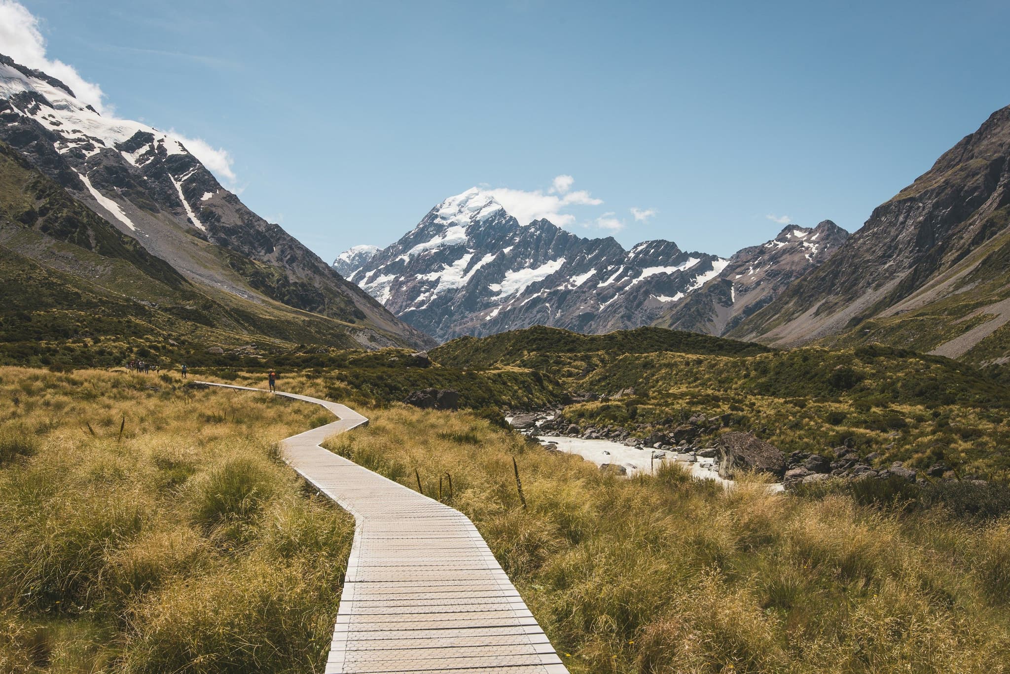
Curious what else Aoraki Mount Cook National Park has to offer beyond this one track? Our New Zealand South Island guide covers Lake Tekapo, stargazing and the drive out to the park in more detail.
The track had a section closed for a while after riverbank erosion damaged one of the swing bridges, but the new bridge opened in July 2026, so the full route is walkable again as of this year. Families do this one comfortably in around two to three hours return, there's no entrance fee, and the surface stays mostly dry and well formed apart from the odd puddle after rain. Because conditions in the park can shift quickly, it's still worth a quick check of the DOC website the night before you go.
Guided tip: Aim for sunrise or the last two hours before sunset on the Hooker Valley Track, when the light on Aoraki is at its best and the car park is far less busy.
Abel Tasman Coast Track: beaches instead of mountains
Not every Great Walk means alpine passes. The Abel Tasman Coast Track is one of the best trails in New Zealand along the coast. It runs 60 kilometres along golden beaches and turquoise bays at the top of the South Island, and most people hike it over three to five days, though kayaking sections or joining a water taxi partway through are both common shortcuts.
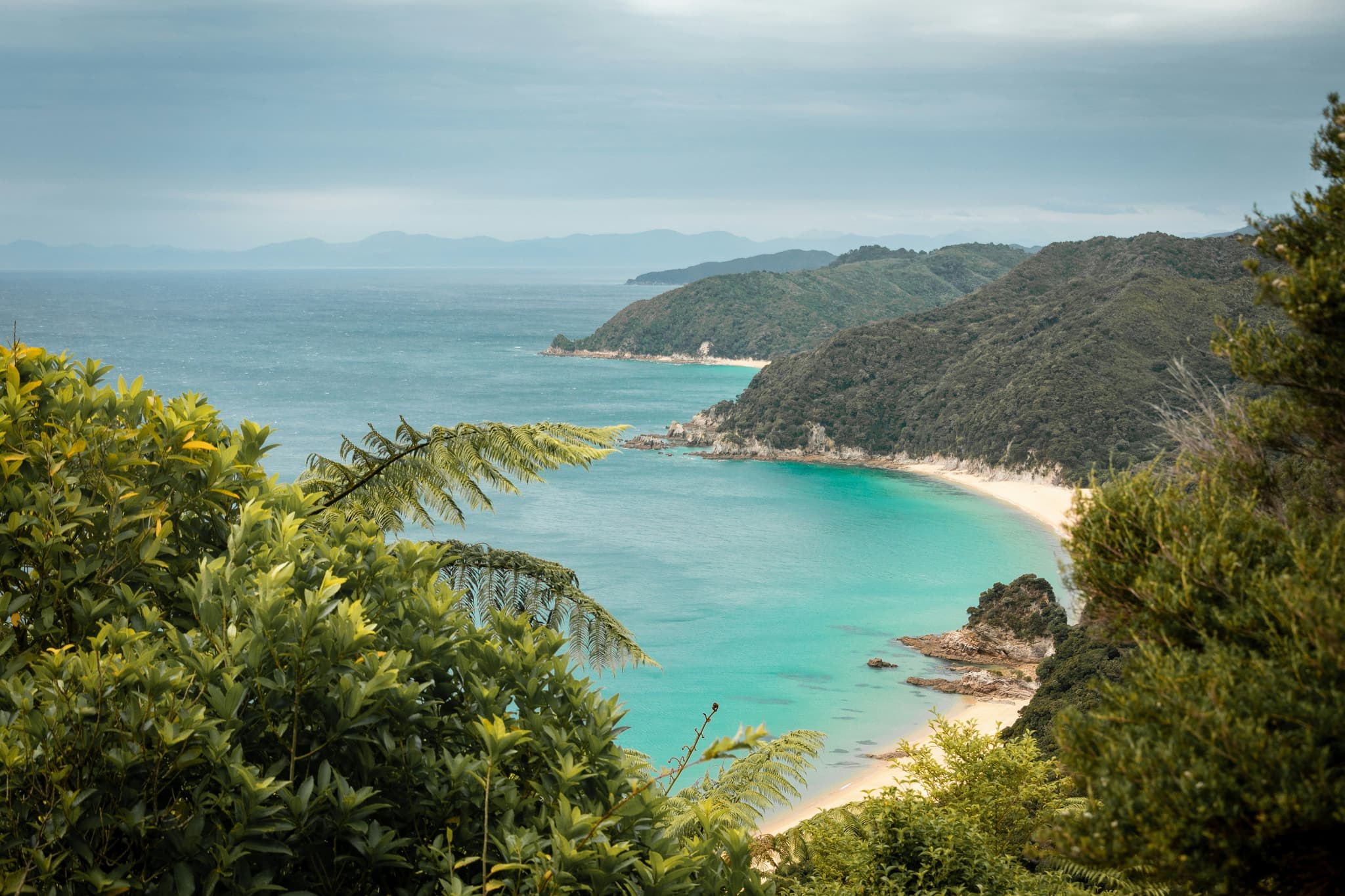
This is the most forgiving Great Walk on the list in terms of terrain, since the trail rarely climbs far above sea level, but tides matter more here than almost anywhere else in the country. A couple of sections cross tidal estuaries that are only safe to walk at low tide, so check tide tables before you set off or you'll be waiting around on the sand. Also read the official track info: Abel Tasman Coast Track official track page (DOC).
Camping runs from around 19 NZD a night, huts cost more, and water taxis along the coast are priced by the leg, usually somewhere between 40 and 90 NZD depending on distance. You'll get your feet wet crossing the estuaries even on a dry day, so pack sandals you don't mind hiking in for those stretches.
Did You Know: Water taxis run along the coast throughout the day, meaning you can hike one section and boat back rather than walking the entire track both ways.
Kepler Track: Fiordland's loop trail
Starting and ending near Te Anau, the Kepler Track is a 60 kilometre loop usually walked over three to four days, which means no shuttle logistics since you finish where you started. The first day climbs steeply to Luxmore Hut, followed by a full day along an exposed ridgeline with views down into the fiords on a clear day.
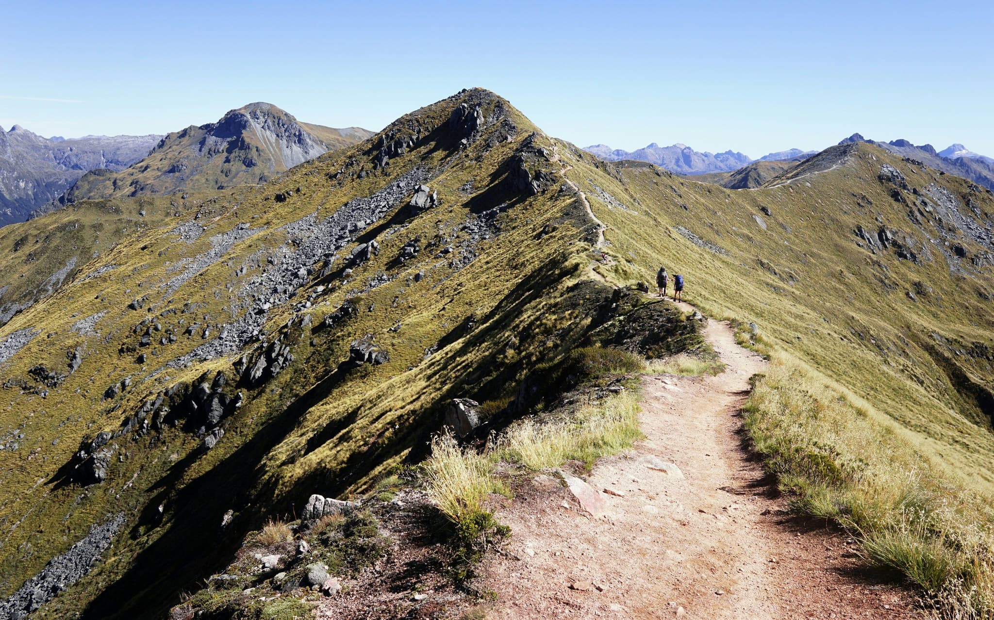
Huts cost around 102 NZD a night for the 2026/27 season, similar to the Routeburn, and bookings open in May. Outside the main Great Walks season, roughly May to late October, this becomes a genuinely alpine trail with ice, snow and avalanche risk on the ridgeline, so it's really only for experienced trampers with the right gear during those months. Even in summer, weather above the bush line changes quickly, and hikers have been caught out by snow in the middle of the season, so pack for four seasons regardless of the forecast in Te Anau that morning. Also read the official track info: Kepler Track official track page (DOC).
Guided tip: Book the Kepler Track huts as early as possible. The ridgeline day is genuinely one of the best sections of any Great Walk, and it fills up fast for good reason.
Mautohe Cathedral Cove: the short walk everyone can do
If you’re looking for great walks New Zealand that anyone can do, the walk to Cathedral Cove is a great option. Officially known as Mautohe Cathedral Cove, on the Coromandel Peninsula covers around three kilometres return from the top of Grange Road, taking around forty five minutes each way over a well formed but steep and stepped trail, and it ends at one of the most photographed rock formations in New Zealand.
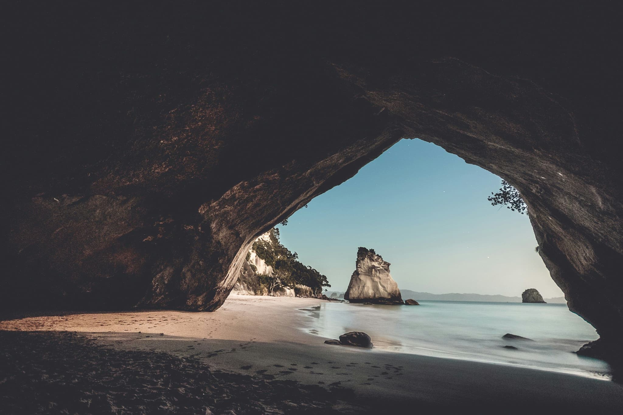
There's no parking at the trailhead itself, so plan on either walking in from Hahei village or catching the shuttle that runs from the Hahei Visitor Car Park every ten to fifteen minutes in summer. The walk is free, though the shuttle costs a small fee each way. Keep an eye on conditions before you go, since this stretch of coast is naturally unstable and DOC does close the track at short notice after heavy rain or storms. Go at low tide if you can, since the beach itself gets a lot more space to spread out. Read more about it in the official track info: Mautohe Cathedral Cove official track page (DOC).
Fun Fact: Cathedral Cove appeared in the Narnia films, and the huge archway carved through the rock formed naturally over thousands of years of erosion.
Key Summit: a taste of the Routeburn in a few hours
If you want the flavour of a Great Walk without the multi day commitment, Key Summit delivers it in under three hours. From the Divide car park on the road to Milford Sound, you'll follow the Routeburn Track for about an hour before branching onto the Key Summit Track, then climb for another twenty minutes through beech forest before opening onto an alpine plateau dotted with small tarns that reflect the surrounding peaks on a still day.
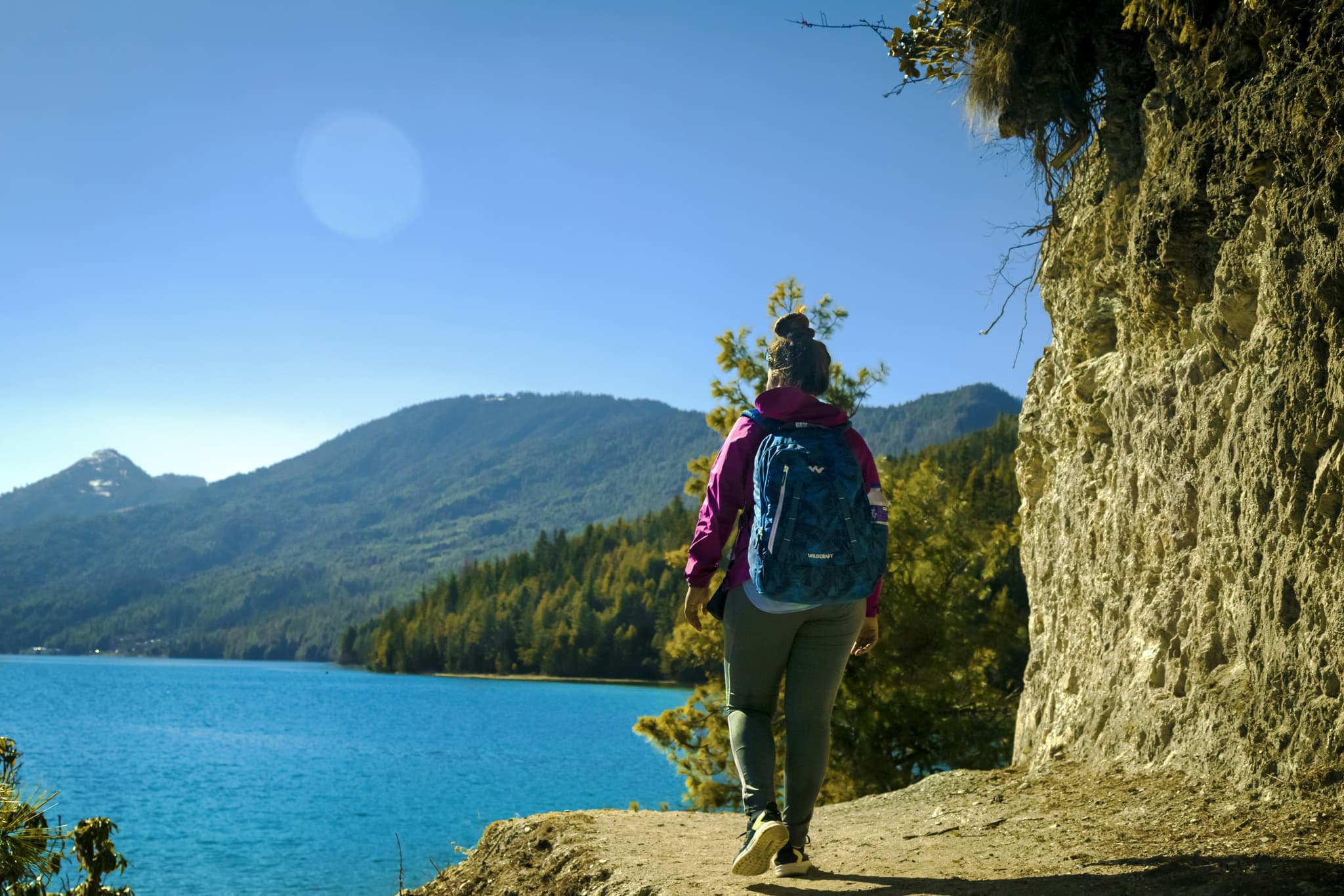
This is one we'd genuinely recommend building into your Milford Sound day trip rather than treating it as a separate outing. There's no fee and no booking required, and the return trip from the Divide car park takes most people around two and a half to three hours all up.
The boardwalk sections stay dry underfoot, but the exposed plateau at the top catches wind and rain fast, so bring a shell layer even if you're only planning a short stop. Also read the official track info: Key Summit Track official track page (DOC).
Pouakai Circuit: a volcano loop on the North Island
Mount Taranaki dominates almost every view on this 25 kilometre loop near New Plymouth, and the Pouakai Circuit is usually hiked over two to three days with a night at Pouakai Hut. Even a shorter version to Pouakai Tarn and back gives you one of the best reflection shots of Taranaki in the country, particularly at sunrise on a calm morning.
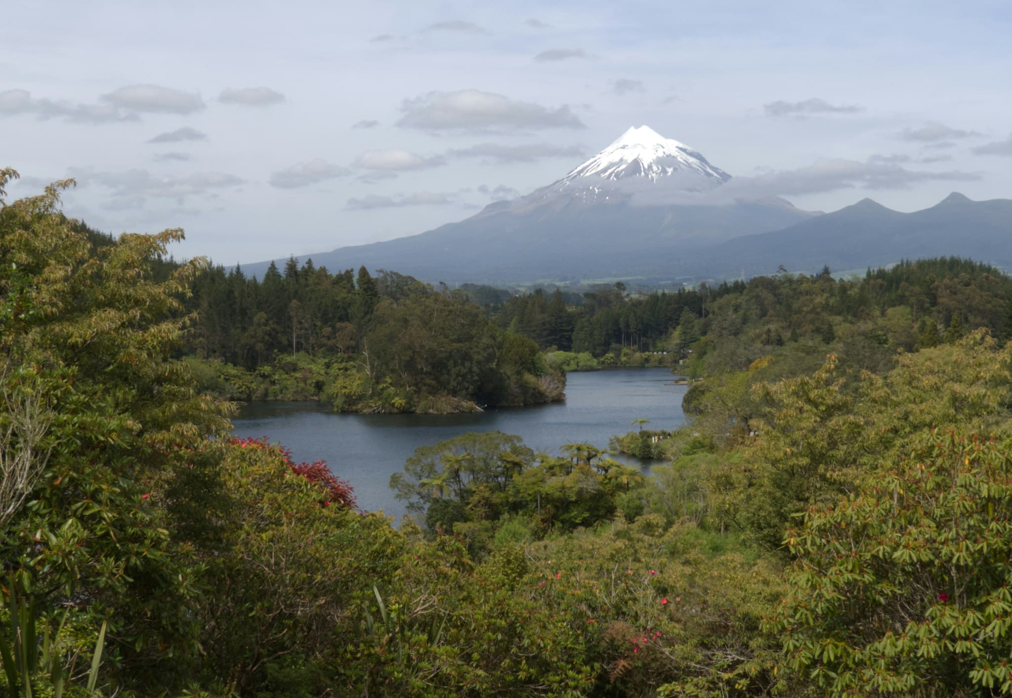
If the full circuit sounds like more than you want to commit to, the day hike version, called the Pouakai Crossing, covers the alpine highlights without the overnight stay, and it's become popular enough that DOC now recommends booking a shuttle for it too. Hut fees on the circuit are much cheaper than a Great Walk, since it isn't one, and the full loop crosses rainforest, alpine tussock and the unusual Ahukawakawa wetland, giving you three completely different environments in a single trek.
Unfortunately, parking at the North Egmont end is limited through most of 2026/2027 due to visitor centre construction, so check current access before you drive out. Read more about it in the official track info: Pouakai Circuit official track page (DOC).
Guided tip: Skip the full circuit if you're short on time and just hike to Pouakai Hut and back, roughly two and a half hours each way, for the sunrise view without the extra night out.
Planning your New Zealand hiking trip
With so many trails spread across both islands, it helps to have a rough idea of where you’re going before you start booking places to stay.
Best time for New Zealand hikes
Weather really does make or break a New Zealand hiking trip. The best time for hiking in New Zealand is generally November to April, when days are longer and most trails are easier to access. For fewer crowds but still good hiking weather, March and early April are especially nice months to go.
Our guide on the best time to go to New Zealand breaks the seasons down month by month, including which months give you the best conditions for hiking.
What to pack for hiking in New Zealand
A proper waterproof shell, not just a light jacket, since weather above the bush line changes fast
Layers you can add or remove, plus a warm hat and gloves even for summer alpine trails
Sturdy, broken in hiking boots, ideally with good grip for wet or muddy sections
More water and snacks than you think you'll need, since huts and cafes are rare on the trail
A downloaded offline map, since large parts of New Zealand’s hiking trails have no phone signal
A basic first aid kit and a headlamp, particularly on any multi day or alpine route
Booking Great Walk huts
The Department of Conservation opens bookings for the coming season around May each year, and the most in demand tracks such as Milford and Routeburn sell out within hours. If you miss out, day sections from either end are still walkable without a hut booking on most Great Walks, and cancellations do pop up throughout the season if you keep checking.
Staying safe on the trail
Weather in the mountains can shift within the hour, even when the forecast in town looks fine. Tell someone your plan and expected return time before you set off on anything remote, and check the MetService mountain forecast rather than the general town forecast for anything above the bush line.
How to pick your first New Zealand hike
Ten hikes, two islands, and honestly, choosing where to start can feel harder than the hike itself. Run through these six questions and you'll narrow it down fast.
How many days can you actually give it? Under three hours, go for Cathedral Cove or Key Summit. A full day, Tongariro or Roy's Peak. Multiple days, look at the Great Walks.
How comfortable are you on steep, exposed terrain? Roy's Peak and the Tongariro Alpine Crossing are both rated hard, while Hooker Valley and Key Summit suit a much wider range of fitness levels.
How far ahead are you booking your trip? If you're planning less than two months out, Great Walk huts may already be gone for your dates, so lean towards day hikes instead.
Which island are you already spending most of your trip on? Pairing a hike with your existing route saves you a lot of extra driving.
Do you want mountains, coastline or forest? Abel Tasman gives you beaches, Milford and Routeburn give you alpine drama, and Pouakai gives you a volcano loop with a bit of everything.
How do you feel about rain? Fiordland is one of the wettest places in the country, so if you'd rather keep your boots dry, the Coromandel or Wanaka area hikes are a safer bet.
So, which New Zealand hike should you pick first?
Ten trails, two islands and honestly, you could spend months in New Zealand and still not run out of new ones to try. If this is a first trip, pair a Great Walk like the Routeburn or Kepler with one or two shorter day hikes such as Roy's Peak or Cathedral Cove, so you get both the multi day adventure and the easy wins along the way.
Whichever trails make your list, book your huts and shuttles early, pack for weather that can change within the hour, and leave a little room in your itinerary. Some of the best moments on these trails happen when you stop rushing to the next viewpoint and just sit with the one in front of you.
Enjoyed This Blog? Continue Reading!
There is more travel inspiration waiting for you on our blog. You can take a look below and start mapping out your next travel adventure!


